
- français
- English
Project description
GO TO : Home - Project - Publications - Talks - Code - Contacts
Optical satellite sensors now provide images of high quality, but of increasing complexity. They can provide information with a spatial resolution of less than a meter, cover the region of visible and near infrared spectrum with a hundred narrow spectral bands and revisit the same region at intervals of only a few days. These images, once treated, provide crucial information to scientists of many different domains such as disaster managment or planning of urban policies.
While these domains all increasingly rely on remote sensing imagery, they are so far impeded by technical limitations. This project aims at pushing those limitations back.
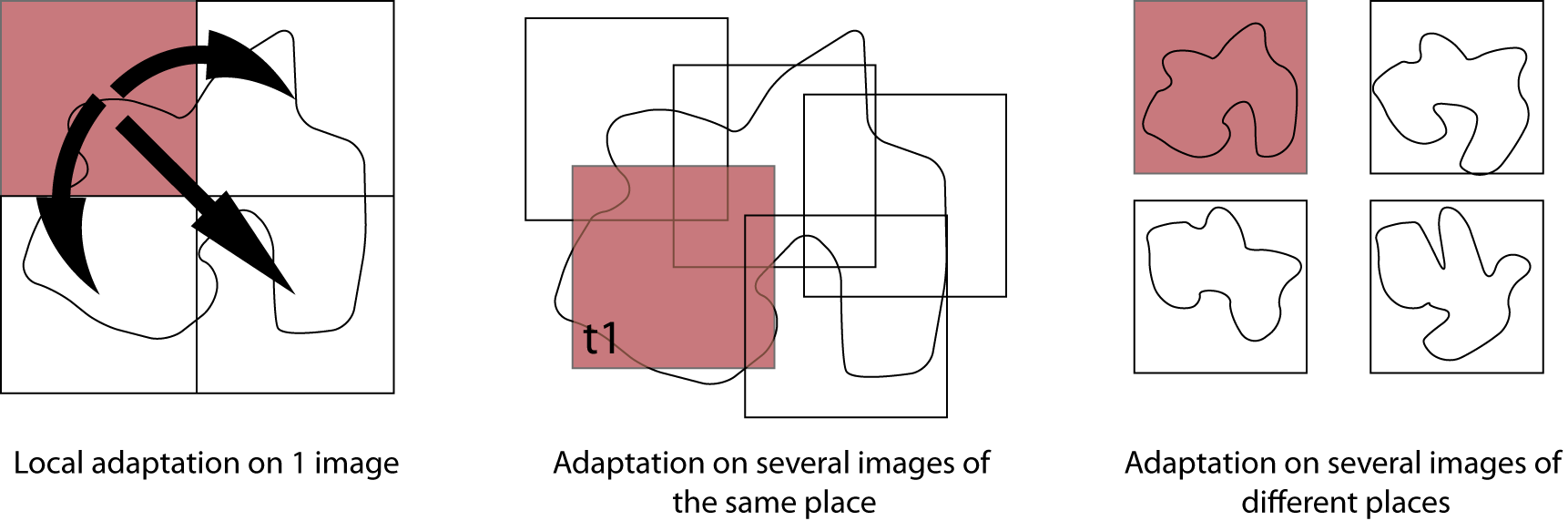
The increase in image resolutions (spatial, spectral and temporal) and the sheer number of sensors acquiring images make it impossible to develop a specific model for each image. On the other hand, applying a model developed for one image to another gives poor results, because the changes in illumination, geometry and landuse types on the new image make the data distribution change, or shift.
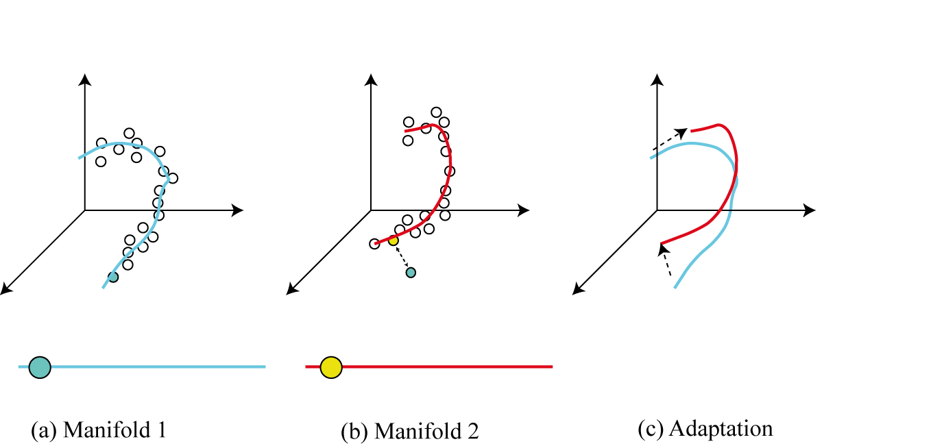
This project studies the nature of those shift and aims at characterizing its nonlinearities and studying the variations of image structure when acquisition conditions change. Focus is put on statistical modelling of data structure (manifold learning) and on models facilitating transfer of models across data acquisitions (transfer learning). Understanding the changes occurring in manifolds will enhance the potential for models transferability and to surpass the “one image / one model” limitation of current remote sensing data processing research. With the developments of the project, it will be possible to develop adaptable classification models that can process images of different zones, taken at different times and by different sensors, thus filling this major gap between current remote sensing research and end-users expectations.
To ensure this last point, the project also aims at developing validated applicative tools for applications needing landuse maps or environmental parameters retrieved from remote sensing data. To this end, real case studies in landscape genetics, disaster management and atmospheric modelling will be considered.
Summarizing, the project will participate in scientific advances in the fields of machine learning and fill theoretical gaps in current remote sensing image processing research that prevent the field to meet users' expectations.